
Cruise port
Saint-Malo - Atlantic Cruise
Explore Saint-Malo on foot: city walls, old town and offshore forts. Tide levels determine access to Grand Bé, Petit Bé and Fort National.
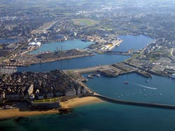
Photo: (public licese) Fabos / commons.wikimedia.org
A walk along the city walls
Saint-Malo is easy to explore on foot from its historic city walls. The walk follows the bastions and gates, offering views across the bay, the Rance estuary and the rooftops of the old town. Along the way, you’ll encounter the history of this corsair city: old cannons stand on the walls, while near the Porte de Dinan, houses recall the shipowners and seafarers who shaped Saint-Malo.
Make time to explore the lanes within the walls. The Porte Saint-Vincent is now the main entrance to the old town; from the walls, you can also see the cathedral and the offshore islands. This combines scenic views and a sense of direction with a stroll through Intra-Muros.
Forts and tides
The tides determine when the offshore rocky islands can be reached. Fort National and the islands of Grand Bé and Petit Bé are accessible at low tide. Plan your detour around the local tide times, and return in good time before the water rises. At higher tide, the fortifications remain impressive sights from the city walls and the beach.
Routes through Intra-Muros
For a shorter visit, choose a section of the city walls and add a stroll through the old town’s lanes and squares. If you’d like to walk farther, you can include the waterfront and viewpoints towards the Rance estuary. The walls tell a story that goes beyond fortifications: the gates, bastions and seaside location show how closely city life and the port have been connected for centuries.
Other coastal destinations in France include Cherbourg and Saint-Nazaire.
Saint-Malo: Port and Old Town
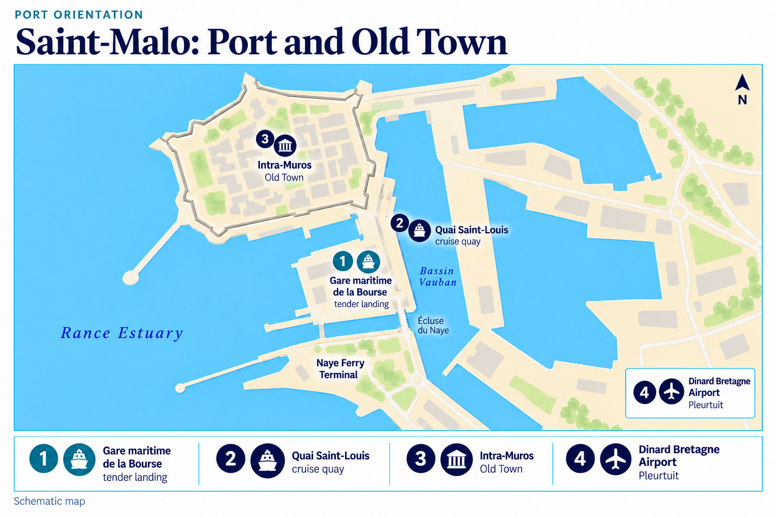 Enlarge map ↗

