
Cruise port
Maastricht: the Maas, city walls and medieval city centre
Maastricht on the Maas: Stiphout landing stages, medieval city walls, Sint-Servaasbrug and Dinghuis.
Maas and landing stage
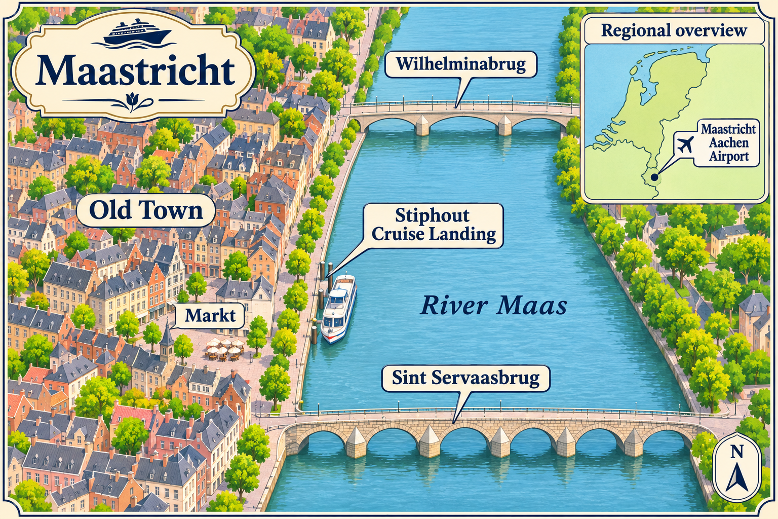
Maastricht lies on the River Maas. For river cruises, Rederij Stiphout’s sightseeing boats depart from landing stages on Maasboulevard 58, between Sint Servaasbrug and Wilhelminabrug. The ticket office is near the large chimneys; solar-powered trains for city tours also depart from the same location.
Medieval fortifications
From 1204, the Duke of Brabant and the Prince-Bishop of Liège shared rule over Maastricht. In 1229, Duke Henry I granted the townspeople permission to fortify the city with a wall. The first line of defence consisted of a moat, an earthen rampart, palisades and wooden gates. The fortifications, around 2,400 metres long, ran along the west bank of the Maas and enclosed areas around the Church of Our Lady, the Basilica of Saint Servatius and the market, with its cloth hall and belfry. They are thought to have been completed in the mid-13th century.
A second line of fortifications was added later. Of the medieval city’s thirteen gates, the Helpoort survives; it is the oldest surviving city gate in the Netherlands.
Bridges and the medieval city centre
Today’s stone Sint-Servaasbrug connects the city centre with Wyck. Construction began around 1280, after the older crossing over the Maas had largely collapsed in 1275. The new bridge was built to the north of the earlier one. On the Maastricht riverbank, a column topped with a stone lion marks the site of the Roman crossing. On the Wyck side, the bridge initially had a removable wooden section, later replaced by stone and steel sections. The bridge has had its present name since 1932; before that, it was called Maasbrug. It was damaged during the Second World War and subsequently repaired, while its medieval core survived.
The late-Gothic Dinghuis on Kleine Staat dates from 1470 and served as a courthouse. Its original entrance features a double staircase with a stone landing.
Trade, crafts and marl
After the decline of the Roman Empire, Maastricht developed into a religious and commercial centre. Churches and monasteries shaped the old city centre. Tanneries were located in the Jeker Quarter, while cloth weavers worked near the market. The medieval street layout combines broad main roads with narrow lanes.
From the late Middle Ages onward, marl quarrying shifted from open-air quarries to an extensive underground network of passageways.
Maastricht River Landing Map
 Enlarge map ↗

